It is already October which means we are only 2 months away from the start of meteorological winter on December 1st. That means it is time for this years winter weather outlook.
El Niño
When ever we start making long range forecasts for northern Georgia, we always turn our heads to the Pacific Ocean, believe it or not. The temperatures of the ocean determine the weather across the United States more often than not. It will create a pattern or El Niño or La Niña and this year we are expecting an moderate El Niño to set up. El Niño is characterized by unusually warm temperatures in the equatorial Pacific. Since we are looking at a moderate setup, we are not expecting full El Niño impacts.
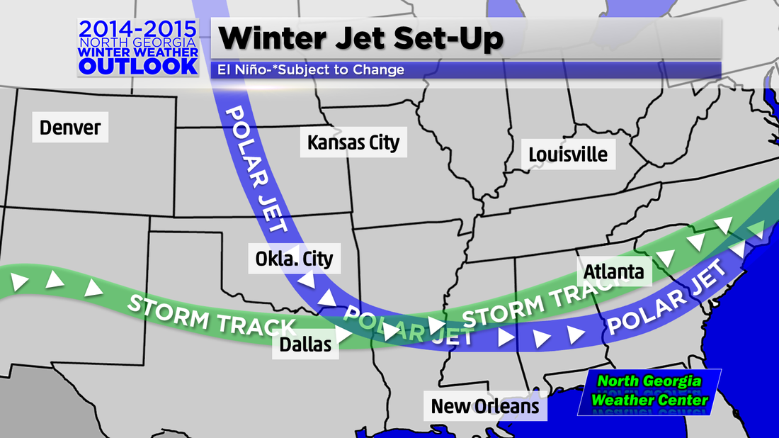
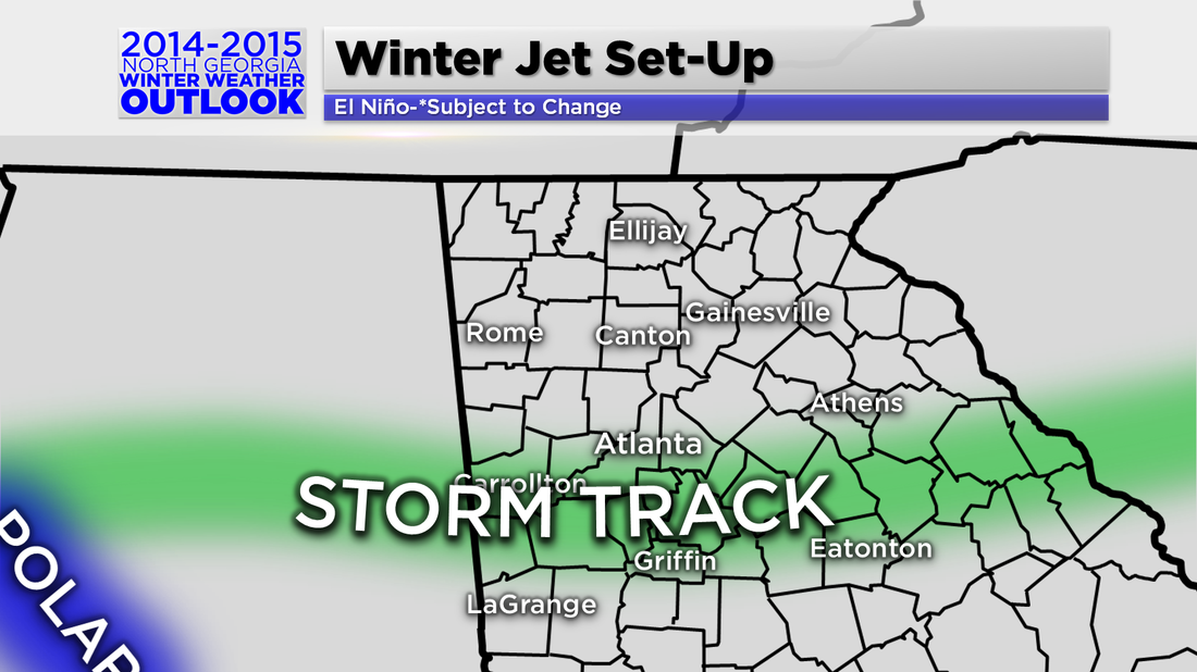
Jet Setup
The Polar Jet is what is the big factor when it come to temperatures. Because of the El Niño set up, it will be farther north over the Pacific region and further south over the east. That means cooler than average temperatures are likely in store for us this winter. I would not be surprised if we saw a long cold spell like we had in 2011 when it snowed and stayed below freezing for nearly a week.
The precipitation factor is determined by where the Sub-Tropical Jet (storm track) sets up. Several computer models have been calling for it to set up across the southern US during the winter for the past few months now. That is good news for the southwest as they will likely get some drought relief.
Winter 2014-2015 North Georgia
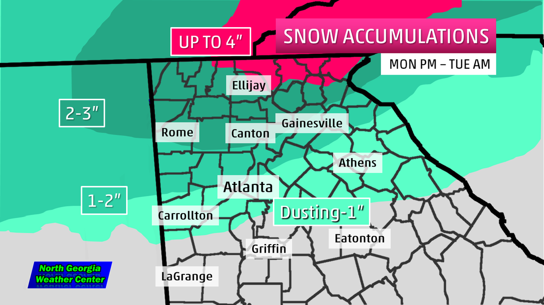
You may have figured out by now what this means for northern Georgia. Yes, it will be cold because the Polar Jet will setup across central and southern Georgia. Yes, it will be wet because the storm track will be right over us. This does mean we will likely see above average snow this year with 4-5 events that effect travel. Ice will also likely be a problem with the Polar Jet hanging around. If it were to set up further north, that means we will be flirting with the 32 degree mark on several occasions and that will create some ice if we have precipitation when that happens.
You may have figured out by now what this means for northern Georgia. Yes, it will be cold because the Polar Jet will setup across central and southern Georgia. Yes, it will be wet because the storm track will be right over us. This does mean we will likely see above average snow this year with 4-5 events that effect travel. Ice will also likely be a problem with the Polar Jet hanging around. If it were to set up further north, that means we will be flirting with the 32 degree mark on several occasions and that will create some ice if we have precipitation when that happens.
 RSS Feed