By: Alex Forbes
Last Updated: 2/9/2014 2:15 PM
Last Updated: 2/9/2014 2:15 PM
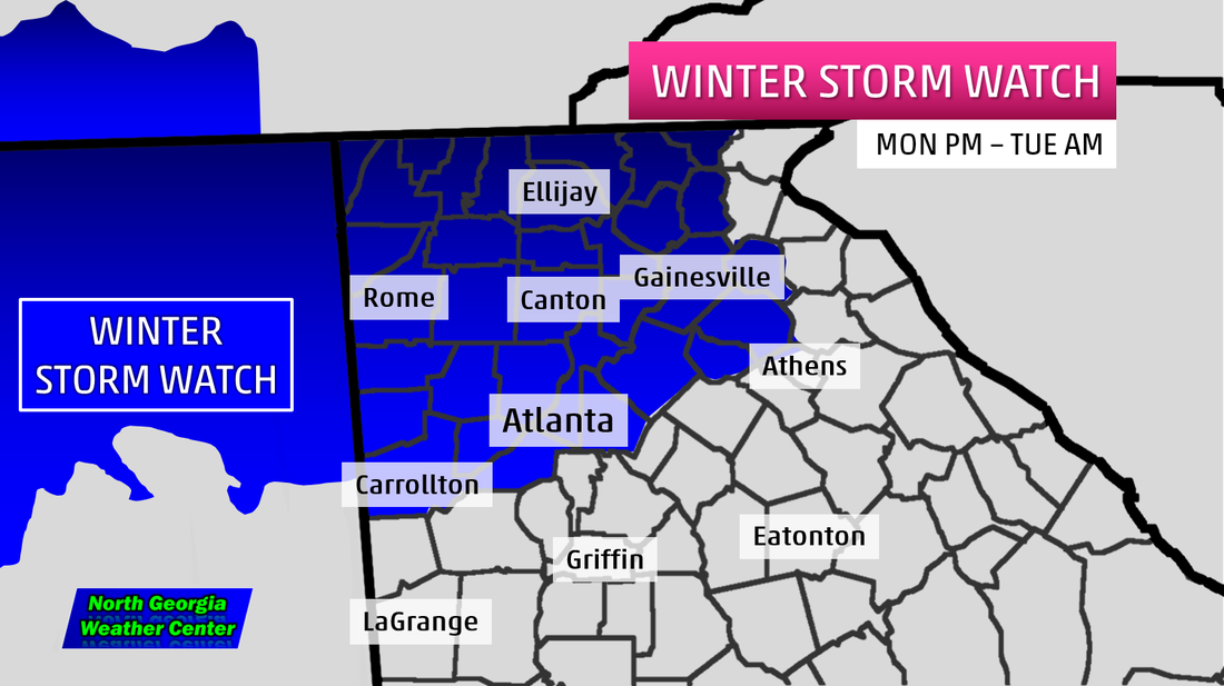 |  |
We will likely see a pretty big ice, snow, and sleet event across Northern Georgia tomorrow night. A Winter Storm Watch has been issued for Banks, Barrow, Bartow, Carroll, Catoosa, Chattooga, Cherokee, Cobb, Dade, Dawson, DeKalb, Douglas, Fannin, Floyd, Forsyth, Fulton, Gilmer, Gordon, Gwinnett, Hall, Haralson, Jackson, Lumpkin, Murray, Paulding, Pickens, Polk, Towns, Union, Walker, White, and Whitfield Counties starting Monday night through Tuesday morning.
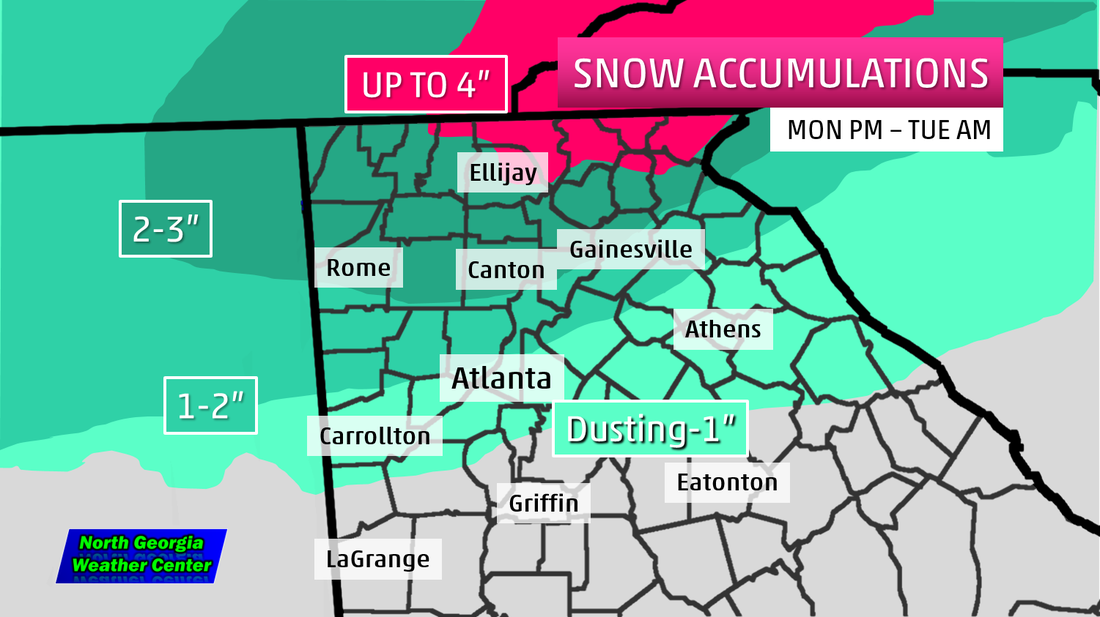
Their will be 2 systems that move through the area. The first system, which has been named "Pax" by The Weather Channel, comes in starting tomorrow night, all models are in agreement that we will see the potential for snow and sleet at first with a dusting south of I-20, 1-2 inches possible across most of Metro Atlanta, 2-3" likely in the Central and Northwest Georgia Mountains,and up to 4" mainly in the Northeast Georgia Mountains.
Then comes the second system. It will likely warrant the Winter Storm Watch to be extended through Thursday. Wednesday morning with the second system, we could have a major winter storm on our hands. Model trends are showing this to be more of an ice event. We will be watching this very carefully as we get closer and closer to the event.
Bottom line is this, 2 winter storms likely within a week across North Georgia. The first one will be sleet and snow across the area. The second appears to be a ice event, still to early to put in a definite yes on the ice. LIKE North Georgia Weather Center on Facebook and FOLLOW North Georgia Weather Center on Twitter for the latest!
Facebook-https://www.facebook.com/ngawxcenter
Twitter- https://twitter.com/NGAWxCenter
 RSS Feed