*If the text is red, you can click on it to learn more about the word or words.
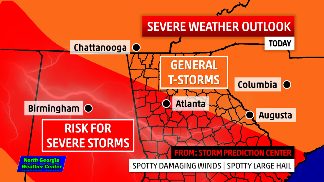 | 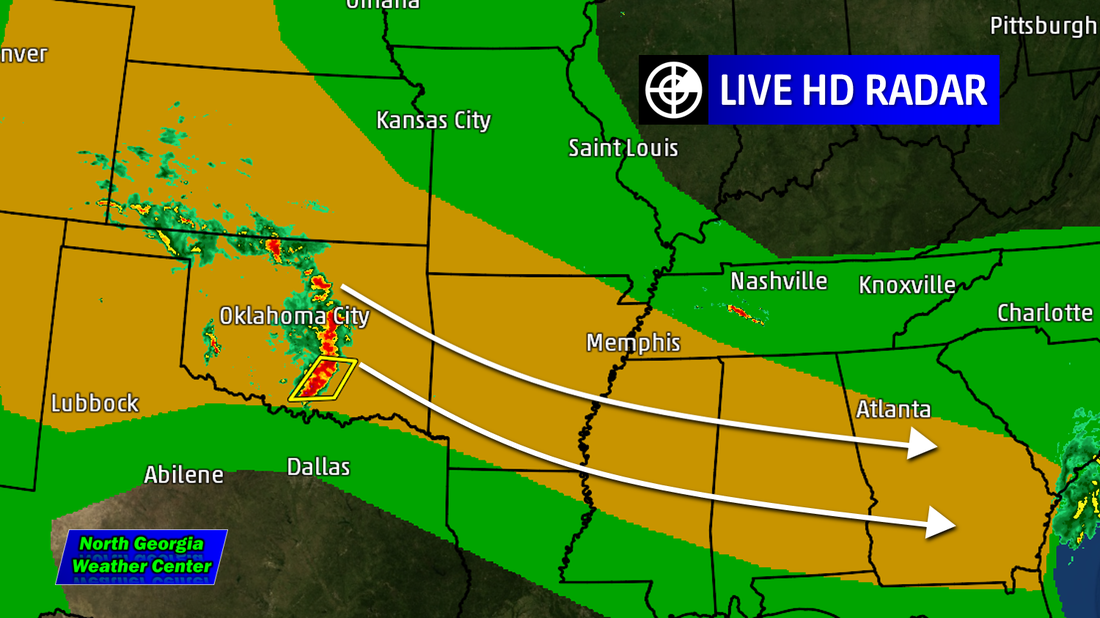 |
This stormy pattern will continue in to today. The Storm Prediction Center in Norman, Oklahoma has put areas in the red under a "Slight Risk" for severe weather. A storm complex has set up in the Oklahoma City/Norman area this morning. That will begin to make its way towards Georgia today. With this, we may see some severe weather after sun set tonight.
This is almost like yesterday. Since we have had stalled front over us, we have seen storm system after storm system. These are called MCS, mesoscale convective system.
This is almost like yesterday. Since we have had stalled front over us, we have seen storm system after storm system. These are called MCS, mesoscale convective system.
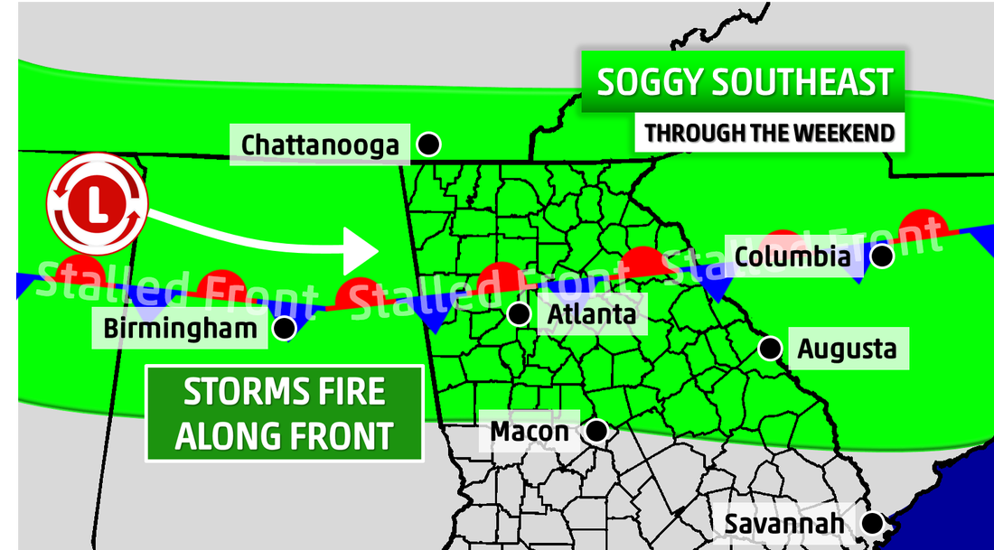
The stalled front serves as train tracks for the MCS's to move along. Today, the stalled front is a little farther south than yesterday. So, the folks down closer to Macon up to the Rome area and southward will see the best chance of storms. Today's storms include the possibility of large hail but, the biggest threat is damaging winds.
We will have all of the watches and warnings on our Facebook and Twitter pages. Be sure to LIKE us on Facebook and FOLLOW us on Twitter!
We will have all of the watches and warnings on our Facebook and Twitter pages. Be sure to LIKE us on Facebook and FOLLOW us on Twitter!
 RSS Feed